Seismic Solutions
Enviros provides integrated seismic solutions across land, transition zone, and marine environments, including streamer and ocean bottom node (OBN) surveys, delivering high-quality subsurface data to support exploration and field development.
Seismic surveys reveal the shape and continuity of geological layers beneath the surface. These images help identify exploration targets and guide field development.
Our Seismic Solutions
The depth of the target, the terrain and access to the survey area determine how seismic data is collected. These conditions guide the choice of energy source, receiver layout and acquisition method.
Towed Streamer Solutions
Survey vessels tow cables fitted with sensors that record seismic reflections along planned survey lines, providing coverage across large offshore areas.environments.
Ocean Bottom Node (OBN) Solutions
Receivers placed on the seabed record seismic signals from multiple directions to help image complex geology and survey around offshore infrastructure.
Tailored Source Solutions
Seismic source selection and configuration reflect the depth of the target, the detail required and the operating conditions at the survey site.
Land Seismic Solutions
Vibroseis trucks generate controlled vibrations that geophone arrays record, providing data to map geological structures beneath onshore sites.
Across Every Survey Environment
Land
Vibroseis trucks and geophone arrays capture subsurface data across onshore terrain, including remote areas.
Transition Zone
Land and shallow-water survey methods connect seismic coverage across marshes, tidal flats and the shoreline.
Offshore
Survey vessels tow seismic streamers along planned routes to map geological layers beneath the seabed.
Deepwater
Ocean bottom nodes record seismic signals at the seafloor to support subsurface imaging for deepwater exploration.Integrated Seismic Solutions
Coordinating survey design, source selection and receiver placement helps maintain coverage where terrain or water depth changes. The resulting data allows geological structures to be traced from one survey area to the next.
What We Use
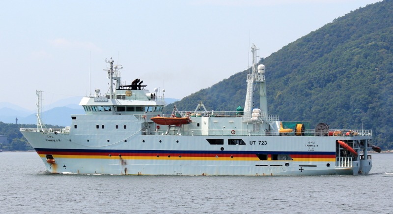
Survey vessels, seismic sources and recording equipment work together to map geological structures beneath the seabed. Water depth, target geology and the detail required guide the choice of equipment for each survey.
Partner with Enviros Group
From project planning to execution, Enviros is your trusted partner for geoscience, environmental, and consultancy solutions. Let’s discuss how we can support your next project.